Bayaguana
Bayaguana is a municipality (municipio) of the Monte Plata province in the Dominican Republic.
As of the Dominican Republic's 2002 census, the municipality had a total population of 34,786 inhabitants, of which 19,001 resided in urban areas and 15,785 in rural areas.
Bayaguana was founded in 1606, when Spain resettled colonists from the northern and western part of Hispaniola closer to Santo Domingo, under the government eviction programme known as the devastations of Osorio. Spanish colonists from La Yaguana and Bayajá (present-day Léogâne and Fort-Liberté, Haiti) were resettled in the town. The economy is centered on cattle-ranching and pineapple and rice farming.
Map - Bayaguana
Map


Country - Dominican_Republic
 |
 |
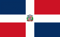
| Flag of the Dominican Republic | |
The native Taíno people had inhabited Hispaniola before the arrival of Europeans, dividing it into five chiefdoms. They had constructed an advanced farming and hunting society, and were in the process of becoming an organized civilization. The Taínos also inhabited Cuba, Jamaica, Puerto Rico, and the Bahamas. The Genoese mariner Christopher Columbus explored and claimed the island for Castile, landing there on his first voyage in 1492. The colony of Santo Domingo became the site of the first permanent European settlement in the Americas and the first seat of Spanish colonial rule in the New World. It would also become the site to introduce importations of enslaved Africans to the Americas. In 1697, Spain recognized French dominion over the western third of the island, which became the independent state of Haiti in 1804.
Currency / Language
| ISO | Currency | Symbol | Significant figures |
|---|---|---|---|
| DOP | Dominican peso | $ | 2 |
| ISO | Language |
|---|---|
| ES | Spanish language |